
Cappadocia Map: Derinkuyu and Nearby Trip Routes
Independent guide; not the museum operator or an official ticket seller.
Place Derinkuyu beside Kaymakli and Goreme museum on a source-based location map, with route choices and transport limits.
Last updated October 2026
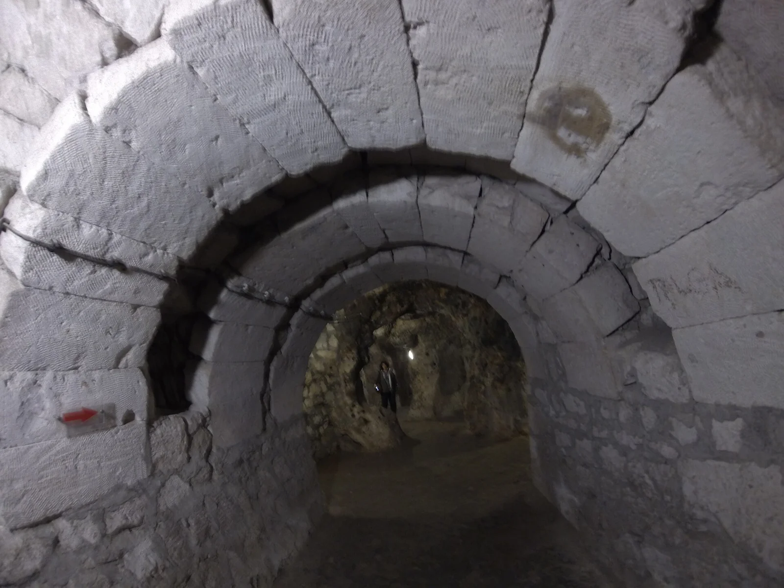
Derinkuyu and two nearby museum sites
Venue-coordinate orientation. No road, bus route or underground connection is drawn.
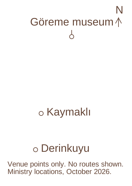
The Ministry coordinate points place Derinkuyu south of Kaymaklı and Göreme Open-Air Museum. This is a location reference only. Each venue needs its own access and transport check.
Complete route-choice records
Day choice: Derinkuyu and return
- Main purpose
- Focus on the underground visit
- Transport task
- Agree waiting and hotel return
- Limit
- Does not add the wider region
Day choice: Derinkuyu plus Kaymaklı
- Main purpose
- Compare separate underground venues
- Transport task
- Arrange surface travel and both admissions
- Limit
- No public intercity tunnel route
Day choice: Derinkuyu plus Göreme museum
- Main purpose
- Pair underground and above-ground rock sites
- Transport task
- Fit both museum access windows
- Limit
- A heritage title is not one ticket
Day choice: Wider southern day
- Main purpose
- Add a named valley or Selime
- Transport task
- Check the supplier route and walking
- Limit
- Not proved by this three-point map
Ministry of Culture and Tourism venue mapping links for Derinkuyu, Kaymaklı and Göreme · · Original point diagram using coordinates from official venue records; no third-party base map
Contents10
This Cappadocia map puts Derinkuyu beside two useful heritage references: Kaymaklı Underground City and Göreme Open-Air Museum. The points come from the mapping links in the Ministry's venue records. Use it to understand their relative positions, then check actual roads and transport for the day you plan.
Derinkuyu is a separate destination south of the Göreme museum point. Kaymaklı sits between them on this location reference. The map shows venue points, not a bus route, road network or underground link. It does not promise travel times or common admission. Arrange surface transport and check each site's access separately.
Cappadocia within Türkiye
Cappadocia is a region in central Anatolia, not a single town or airport. UNESCO's heritage description places the rock sites within a landscape that includes underground towns as well as rock-cut churches. That helps explain why “a Cappadocia visit” can mean quite different days.
You can stay near one part of the region and still need transport to another. A hotel view of rock formations does not establish that Derinkuyu is a walk away. Start with the accommodation address and the venue address rather than treating the region's name as a small compact place.
The World Heritage title is also not a ticket bundle. A landscape description joins places for their heritage importance. Each managed museum has its own access and admission arrangements. Do not assume a single local ticket covers every point on a regional map.
A Cappadocia map for a Derinkuyu trip
The three plotted places have specific official venue records:
- Derinkuyu Underground City: the underground visit beneath the town of Derinkuyu.
- Kaymaklı Underground City: a separate underground museum in Kaymaklı.
- Göreme Open-Air Museum: a separate rock-cut museum site near Göreme.
The points are drawn from those records' destination coordinates. We do not copy a commercial base map. There are no roads or administrative borders in the drawing. The open space between points is simply blank, not evidence that the ground is flat or that a direct road joins them.
North is up. Use the point names to see the order of places in the region. Do not use straight-line spacing to quote a driving time. A car follows roads, and a bus follows stops and a timetable. Neither moves along an invisible straight line drawn between attractions.
Derinkuyu and the main visitor bases
Göreme, Ürgüp, Uçhisar and Avanos can appear in tour pickup lists. Their inclusion is a supplier service detail, not a universal regional shuttle rule. Give the accommodation's actual address when requesting transport. A town name alone may leave the meeting point and any supplement unclear.
Derinkuyu's museum address is in Bayramlı Mahallesi on Şemşili Yolu Sokak. Save it before travel. For Kaymaklı, the Ministry lists Camii Kebir Mahallesi, Eşref Ayhan Caddesi. These are different entrances, even when both places appear in one underground-city comparison.
A base is useful when it suits the rest of the trip too. Decide whether you want nearby walking, restaurants or a quiet property, then ask how the Derinkuyu ride will work. Do not choose solely on the belief that every “Cappadocia hotel” gets the same pickup or drive time.
Airports, roads and transfer points
An airport arrival is a separate leg from a museum visit. Check the airport named on your flight, then the destination of the transfer you book. A hotel transfer into Göreme does not mean the vehicle continues to Derinkuyu. If you want a direct airport-to-site plan, request that exact leg and agree what happens to luggage.
Use the DHMI airport directory and the relevant airline for airport and flight details. The Kayseri airport page is one official reference. This map does not plot an airport pin whose exact location has not been checked in the retained venue set.
For a driver, state the route in order. Include the pickup address, first venue and final hotel. Ask whether waiting is covered at each stop. A fare for a single transfer cannot be compared fairly with a vehicle that waits through several visits.
For public transport, check each leg with the operator. The museum coordinate is not a bus stop coordinate. Ask where the service leaves and where you get off. If a connection needs a walk or taxi at the far end, include that in the plan before leaving your base.
Nearby heritage stops
Kaymaklı is a useful comparison because it is another underground visitor site, not because it is a free extension to Derinkuyu. Check its own ticket and open route. Visiting both needs surface travel between their separate entrances. No public underground connection is supplied here.
Göreme Open-Air Museum answers a different question. It places rock-cut religious spaces in an above-ground museum visit. The Derinkuyu visit focuses on linked underground rooms and passages. Pairing them can give two distinct views of the region's rock-cut building, provided there is enough time for each.
Do not add an attraction simply because its name appears close on a map. Check what the visit actually involves. A viewpoint can be a short stop, while a museum may involve admission and walking. A valley walk also needs a start and finish, not just one point in the middle of the landscape.
Route choices for a Derinkuyu day
Direct visit and return
A direct plan has the fewest joins. Your transport takes you to Derinkuyu, waits or returns as agreed, then takes you back. It fits a trip focused on the underground site. Its limit is that you do not also cover the wider southern route without making a new plan.
Derinkuyu and Kaymaklı
This pairs two underground sites for comparison. It needs two admissions and a confirmed vehicle or transport plan. Decide what you want to compare, such as rooms, passages or the museum accounts. Do not treat the second visit as merely a way to increase the number of stops.
Derinkuyu and Göreme museum
This pairs underground shelter with an above-ground rock-cut museum. Ask a driver or supplier to set the order around the actual admission windows. If one site is the priority, say so and leave room for it. A late visit should not rely on arriving after a ticket desk has closed.
A wider Green route
A southern tour may add Ihlara and Selime. Those stops lie outside this three-point reference, so it cannot prove that whole loop works. Read the supplier's route and walking description. A Green Tour is a service product, not a line that the museum has drawn on this map.
Using and printing the map
The map and reference records remain useful without JavaScript. In print, keep the source and limitations alongside the points. Save the official venue addresses separately if you need them in a taxi. An orientation image is a poor place to hide an exact meeting instruction.
For current roads, use a mapping service and follow the local signs. If you use OpenStreetMap, its copyright and data terms apply to any map or data you reproduce. Our diagram uses Ministry venue coordinates and does not reproduce an OpenStreetMap base layer.
Tell us if a venue mapping link changes or points to the wrong place. A correction should name the venue and official record. We can recheck the point without changing a road or inventing a new entrance.
Frequently asked questions
Does the map show a bus route?
No. It shows three venue locations from official mapping links. A bus needs its own departure point and timetable. Check the operator for each leg, including the last return. A road or a short gap between points does not establish that a direct public service connects them.
Can I visit all three with one ticket?
Do not assume that. These are separate managed venues. Check any museum pass by its exact site list and your eligibility, or buy the required admissions. A heritage inscription is not an admission product. A tour may package some tickets, but its own inclusion list must name them.
Why are there no driving-time labels?
The source points do not supply current road travel times. Traffic, pickup and the chosen route affect a journey. A straight-line estimate would give a false sense of certainty. Ask the operator or driver for the planned day, and keep a return margin rather than treating a map gap as a timetable.
Continue planning your visit
Verdict on a Cappadocia map
Use this Cappadocia map to place Derinkuyu relative to two other museum sites. Use current transport sources to join them and the venue records to check access. That keeps a regional orientation from becoming an unsupported route promise. Sources checked and editorial update: 14 October 2026.