
Red Valley Cappadocia: Red and Rose Valley Walking Choices
Independent guide; not the museum operator or an official ticket seller.
Plan a Red Valley viewpoint or checked walk, keeping Rose Valley names, route endpoints and return transport clear.
Last updated October 2026
Route choice without an invented trail line
No checked trailhead coordinates or continuous trail survey were located. This table is the map substitute: each route field remains explicit rather than fabricated.
Complete planning records
Visit form: Viewpoint
- Start and finish
- Exact viewing point to confirm locally
- Time basis
- No universal duration assigned
- Access and return
- Current permitted approach and pickup
Visit form: Return walk
- Start and finish
- Checked start with turnaround
- Time basis
- Route-specific estimate including return
- Access and return
- Local path status and usable daylight
Visit form: One-way walk
- Start and finish
- Both endpoints to confirm
- Time basis
- Exact route and planned pauses
- Access and return
- Final ride arranged before starting
Visit form: Guided walk
- Start and finish
- Supplier names actual path
- Time basis
- Product-specific group estimate
- Access and return
- Current route and shortened-walk terms
Official tourism place context plus local route checks required · · Original source summary and editorial planning choices.
Contents8
Red Valley Cappadocia is a surface-landscape choice, with a viewpoint visit and a full walk requiring different plans. Red and Rose Valley names are often used together, but a route needs its actual start and finish. Choose a locally checked option rather than follow an unverified loop drawn from several travel accounts.
Use Kızılçukur for the Red Valley name and Güllüdere for the neighbouring Rose Valley context. Official tourism sources discuss the walking landscape, not every current path. A viewpoint stop can be a different product from a valley walk. Confirm the exact route, conditions, daylight and final pickup before adding either to a Derinkuyu day.
How Red Valley Cappadocia and Rose Valley relate
The official GoTürkiye place guide discusses Red Valley in the local landscape near Çavuşin and Ortahisar. The regional culture guide describes the wider Red and Rose Valley setting. Sources checked October 2026. These are landscape accounts, not current trail surveys.
Keep the names attached to the actual place a guide or driver intends to use. “Red and Rose” in a product title does not state which paths connect the stops. Nor does it name whether the plan is a ridge viewpoint, a valley-floor walk or a route through both. Ask for the start and finish in plain terms.
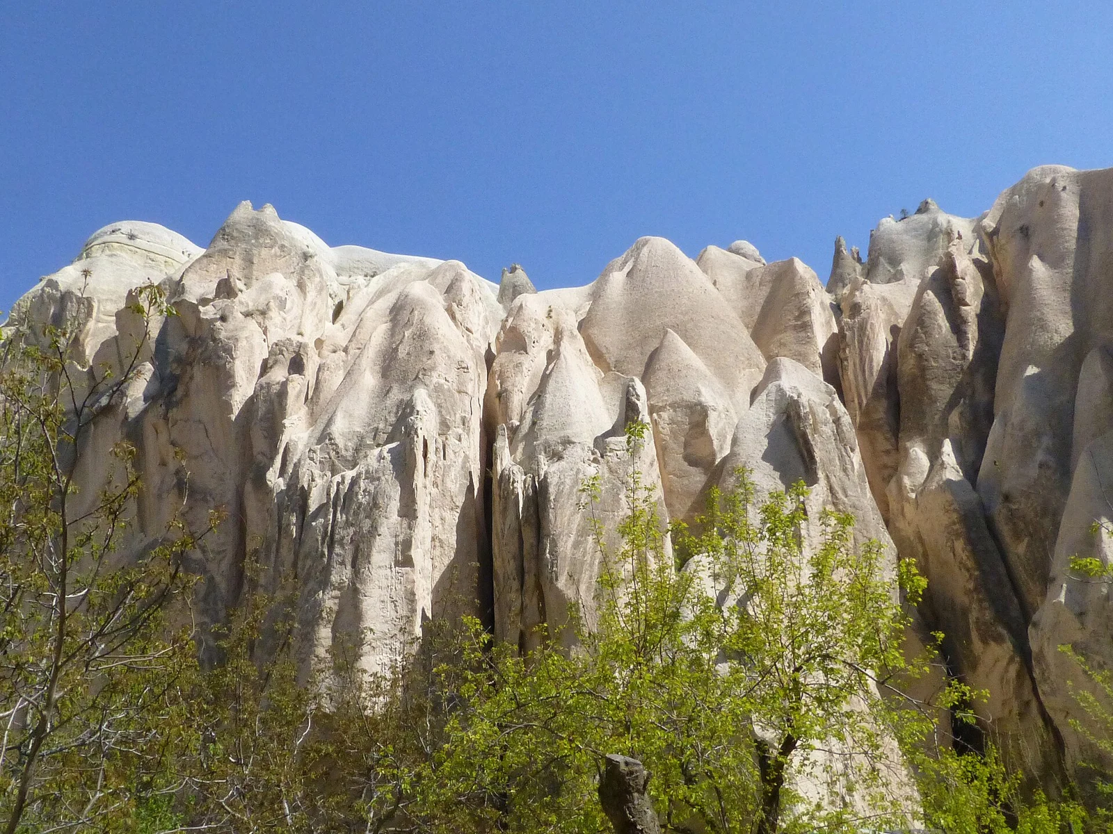
The hero is a dated photo named by its creator as Kızılçukur. It shows that landscape at capture, with its licence and credit below it. It does not record the present route status, show every fork or name a current public entrance.
Choose a checked walking option
The sources consulted for this page do not provide a dated, fully checked route with trailhead coordinates. We do not invent a map line or a universal walking time to fill that gap. Obtain the actual route from a local guide or current access record before treating it as a plan.
| Visit form | Useful for | Required check |
|---|---|---|
| Surface viewpoint | A landscape stop with arranged road access | Exact approach, permission and pickup |
| Return walk | A path with a clear turnaround | Current route and daylight for both directions |
| One-way walk | A distinct start and finish | End location and confirmed return ride |
| Guided Red and Rose route | Local route choice and explanation | Which named paths, group pace and current conditions |
Scroll for more →
The table describes choices to confirm. It is not a list of measured routes. A route estimate should be specific to the chosen path and include stops and the return arrangement. A time for a viewpoint should not be reused for a valley walk simply because the two share the same name.
Trailheads, transport and turnaround
Ask where you will begin and where you will finish. If the route returns to the same point, agree the waiting or pickup plan. If it ends elsewhere, obtain the final pickup before starting. A map label for a broad valley is not a complete end-point agreement with a driver.
For a guided walk, ask what happens if the group turns back. The answer should cover transport as well as the path. A supplier may describe several route possibilities; confirm which one is planned for your date. The guide's local choice can be useful, but it should not remain an unnamed product until arrival.
For a self-planned walk, use a current route record with a clear source. Do not merge fragments from several routes into one new loop. A path shown on one map may not connect to the next point in the way a summary implies. If the route cannot be shown, choose a simpler visit form.
Terrain, daylight and conditions
A broad landscape photo cannot show footing along a whole path. Ask about the current terrain and any sections which affect your group. This guide does not give a universal difficulty or a promise that every visitor can use the same route. A route-specific answer is more useful than a blanket “easy hike” label.
Check the Nevşehir weather forecast and obtain local route advice. Rain, ice or poor visibility can change a walking plan. A regional forecast does not inspect each slope or opening. Keep a shorter fallback if the chosen path is not suitable on the day.
Work backward from the return. A sunset viewpoint does not guarantee enough light for a later valley walk. Date-specific daylight and the route's terrain matter. Give the return its own margin rather than count the last light as usable walking time through every part of the valley.
Follow access signs and do not enter an unmarked rock-cut space just because it is visible from the path. A church or cave label on a map is not permission to go inside. The public route and current manager's directions are the relevant access sources.
Fit a walk around a Derinkuyu visit
Give Derinkuyu a firm place first. Resolve the museum's hours and last admission, then confirm the full surface journey. A multi-stop Green Tour may already use most of the day's flexible time. Do not add a full valley walk by assuming the underground visit and all transfers will take the shortest reported times.
If you mainly want the Red Valley landscape, a confirmed viewpoint stop may fit better than a walk whose route and return remain open. That is a planning recommendation, not a claim that the viewpoint is accessible to everyone. Its own approach and current access need a check.
If walking is a main interest, give it a separate block in a longer itinerary. This leaves room to choose the route according to conditions. A spare day can be useful without becoming a promise of perfect weather. Avoid making a late return from Derinkuyu the only opportunity to walk.
Map, access checks and corrections
This page supplies complete route-check records rather than an unsourced trail diagram. A future mapped route should name its start, finish, source and date. It should distinguish a recorded line from current access. A simple colour on a tourism map cannot answer all those questions.
The official tourism sources show the landscape context. Local route advice supplies the operational layer. Keep them separate when a correction is made. A new photo may improve recognition of a place without changing the status of the path beyond it.
Continue planning your visit
Verdict on Red Valley Cappadocia
Choose Red Valley Cappadocia through a specific viewpoint or checked walking plan. Keep Red and Rose names clear, agree the end-point transport and allow daylight for the return. Pair it with Derinkuyu only when the day's confirmed route leaves enough usable time.