
Derinkuyu Depth: Levels, Measurements and Visitor Access
Independent guide; not the museum operator or an official ticket seller.
Understand Derinkuyu's reported depth, shaft measurements and level count, and why these do not define the current visitor descent.
Last updated October 2026
Contents13
- Derinkuyu depth in the museum account
- Derinkuyu depth and level-count sources
- Total extent versus the public route
- Why reported measurements differ
- An original measurement key
- Reading the cross-section
- Depth does not prove population or duration
- A clear way to record a measurement
- What a stronger survey record would show
- FAQ: access questions and sources
- Compare the room depth with the water-shaft figure
- Continue planning your visit
- Verdict on Derinkuyu depth
Derinkuyu depth is often given as one headline figure. But a well, a shaft and a room system can have different depths. The public museum account is useful when its numbers stay attached to the features they describe. It cannot define the route open to visitors today.
How deep is Derinkuyu? The museum's public account gives an approximate depth of 85 metres. That figure is not a promise that visitors descend 85 metres. Published accounts also discuss shallower shafts and the thickness of the rooms. Read each number with the feature it describes.
Derinkuyu depth in the museum account
The short answer is “about 85 metres in the museum account”. The useful answer adds a second question: depth to what? A well, a shaft and a floor are different endpoints. The lowest point of one feature does not have to be the lowest point reached by a visitor. A number without its endpoint can hide that difference.
The Turkish Museums Derinkuyu record reports the approximate figure. It also describes a ventilation shaft of 55 metres which could serve as a well. These are statements in a museum visitor account, not a new survey made by this guide. Source checked October 2026.
There is further detail in scholarly work. Mehmet Özgür Mutlu's 2008 thesis, printed page 14, cites an earlier account which distinguishes a shaft near the entrance from a deeper water shaft. It gives 40 metres for the first and 85 metres for the second. This is a citation within the thesis. It should not be presented as a fresh measurement by its author.
These accounts do not justify choosing one figure and treating every other number as a mistake. They may concern different features or use different reference points. The right response is to preserve those labels. The current depth of the visitor's descent remains a separate question for the museum.
Derinkuyu depth and level-count sources
| Figure or description | Feature or source context | How to read it |
|---|---|---|
| About 85 metres | Overall depth in the Turkish Museums visitor account | A reported figure, not a public-route guarantee |
| 55 metres | Shaft described in that visitor account | Not a count of rooms or visitor stairs |
| 40 metres | Near-entrance shaft in an earlier account cited by Mutlu | A different stated endpoint from the deep well |
| 85 metres | Water shaft in that cited earlier account | Do not equate a well with a walkable floor |
| Eight levels | Ministry description of the site | Does not prove that all eight are open today |
| Probable thickness of about 40 metres | Mutlu's geological interpretation of the complex | Not the same measure as the depth of a well |
Scroll for more →
The Ministry's current venue listing describes eight levels. It does not provide a dated route-by-route depth table. This matters because “eight levels” can be turned into “eight levels open to visitors” when the text is repeated. Those are not the same statement. Venue record checked October 2026.
A level count also needs a convention. A passage may slope between two rooms. A shaft may pass several floors. If different authors group those features in different ways, their count may change. Without the plans and the counting method, a neat list of floors may be less precise than it looks.
For a visit, separate the site's documented structure from the route selected for public access. The route could pass rooms on several levels without reaching the lowest known feature. It could also avoid a section which appears on an old published plan. A historical plan is evidence of the layout recorded at that time, rather than permission to use every passage now.
Total extent versus the public route
Imagine a building with a well beneath its lowest room. The well's depth would not tell you how far a person walking through the rooms descends. The same distinction applies here. This example explains the measurement problem; it is not a claim that Derinkuyu has the exact shape of that imagined building.
The surface is another issue. A depth can be measured from a local ground point, an entrance threshold or a surveyed datum. These points need not share the same height. If a source does not say where the measurement begins, retain that uncertainty rather than supplying a point of your own.
Nor is vertical depth the same as the distance walked. A route can descend, turn, run across a floor and climb again. Its walking length may be much greater than its change in height. A figure in metres below ground cannot be used as a walking-distance estimate. It also cannot tell you the number or steepness of the steps.
For those deciding whether to enter, the practical questions are about the route. Ask about the current open sections, narrow places and ways to leave. A large depth figure in a headline does not answer these questions. Museum staff can describe the route in use that day; this guide cannot promise a fixed path from a historical depth account.
If a tour description claims access to the deepest level, ask the supplier to name the level and the museum's current access rule. A guide does not gain permission to enter a closed section merely by selling a tour. The same rule applies to an old photograph taken in a place now outside the public route.
Questions to send before booking
- Which levels are on the present visitor route?
- What is the lowest part visitors actually reach?
- Does that answer describe a room, a shaft or a well?
- Are there sections where people must crouch or pass in single file?
- Can a visitor turn back, and how should they ask staff to do so?
- Does the quoted time allow for moving through the site, rather than just reaching it?
These questions help turn a headline number into a workable visit. A supplier may not know every dimension. It should still be clear about what it is selling and where it gets its access information. If the answer is only “the city is 85 metres deep”, the practical question has not been answered.
Why reported measurements differ
There are several kinds of difference worth checking before treating two figures as a dispute. One number may describe a shaft and another the rooms. One may be approximate while another comes from a drawing. One may use the ground beside the entrance while another uses a different surface point. The labels tell you more than the numbers alone.
The date of a source also matters. A new survey could refine an older estimate. But the mere fact that a webpage was updated does not mean its depth was remeasured. The page may repeat an older account. To assess the measurement, look for the original survey, author and method rather than just the latest webpage date.
Mutlu's thesis is useful because it states its geological aims. It studies the host rock and joints, and reports work on rooms in the two underground cities. Its abstract gives a probable thickness for each complex. That scope is different from the museum's short visitor summary. The thesis is not a current access notice or a room-by-room archaeological chronology.
Do not average the reported figures. An average of a shaft's depth and a room system's thickness would describe no real feature. It would create a false sense of precision while losing the distinction the sources make. Keep each figure beside its feature instead.
The same caution applies to ranges. Saying the city is “40 to 85 metres deep” might sound fair, but it can imply that the uncertainty concerns a single endpoint. Here, the evidence may concern different endpoints. A labelled table is more helpful than a range which blurs them together.
An original measurement key
The bars do not identify three shafts standing beside one another. They are a way to keep three reported measurements apart. Their placement on the page has no geographic meaning. The labels and the source table provide the explanation, so the graphic is not needed to understand the answer.
This is also why the key contains no stair line. Adding one could imply that the public route descends through the full depth. A schematic should not supply an access claim which the source does not make. We have left that question with the current museum route information.
Reading the cross-section
The museum brochure includes a site drawing and numbered spaces. It is a better starting point for the layout than an unattributed image shared online. Read its caption and key before treating the drawing as a measured view of all known areas. We link to it rather than reproduce it without a clear reuse grant.
A plan normally shows relations across a floor or projected layout. A section shows a cut through a structure. A pictorial view may combine both ideas to make the site easier to understand. Check which type you are looking at. A picture with many stacked rooms is not automatically a surveyed vertical section.
The key should tell you what the symbols mean. A shaft can be drawn as a straight line, a narrow shape or an opening. A passage may appear to connect rooms that lie at different depths. If the drawing compresses several parts of the site onto one page, a visual overlap does not by itself prove a physical connection.
Check for a scale before measuring from the page. A diagram without one cannot support an exact room width. A scale for one part may not apply to a separate inset. A drawing copied into a webpage can also be stretched. Measuring pixels from that image would add another source of error.
Then check the access layer. Does the drawing mark the public route, or just the site's features? Does it carry a date for closures? If not, it should be used to understand the documented layout rather than to plan an unmarked walk. The museum's present signs and staff directions take precedence during the visit.
Be cautious with colourful cutaways which show complete kitchens, lit rooms and people living below ground. These may be illustrations of a proposed use. Unless their details are tied to a source, they cannot prove the exact shape of a missing space or the number of people who once occupied it. A persuasive image can still be an interpretation.
Depth does not prove population or duration
More depth does not automatically mean more living space. A deep well can occupy a small area. Many floors can contain small rooms. To estimate capacity, a study would need the usable area and assumptions about how it was used. A depth number alone cannot supply either of those things.
It also does not prove how long people remained underground. That would involve water, food, air and evidence of actual use. A deeper part might have had a very different role from a room near an entrance. The engineering question and the historical question overlap, but one does not answer the other by itself.
Avoid using the deepest reported feature as a claim of superior safety. Nor should the figure be used to dismiss a visitor's concern about the current route. Those are different questions. A person deciding whether to enter needs an accurate account of the passages, not a comparison between the headline depth and another underground site.
A clear way to record a measurement
When saving a depth figure for your own notes, give it a short record with five fields. Write the number and its unit. Name the feature. Note the start and end points if stated. Identify whether the source calls it measured, approximate or reported.
Finally, record whether it says anything about current public access.
For example, the public museum account's approximate depth can be retained with its wording and source. The access field should remain “not established by this figure”. That avoids quietly adding a visitor claim when the note is later reused. It is better than writing only “85 m” beneath a photo.
Use the same approach when listening to a guide. If the guide gives a number for a well, put “well” in the note. If they quote a survey, ask which one. You need not interrupt every explanation, but these simple labels help you remember what the number actually referred to.
What a stronger survey record would show
A survey is most useful when another reader can understand how its points were tied together. Look for a stated reference height and a key to the surveyed features. If the deepest mark belongs to a well, the record should make that clear. If it belongs to a room floor, that should be clear too. A bare number cannot be checked in the same way.
The record should also show its scope. Did the team enter all known areas, or work in a selected part? A study may be sound within its stated area while leaving other spaces outside its scope. That limit does not make the work poor. It means that a reader should avoid enlarging its claim to cover parts it did not record.
An estimate can still be useful when its basis is stated. For example, a geological interpretation may suggest the thickness of a cut room system in a rock layer. That answer helps with a rock study. It should retain its label as an interpretation and not become an exact measurement of every floor in a visitor guide.
Finally, check whether later work is being cited from an older source. A thesis can give you a route to the original literature, but the cited passage is still a report of that earlier work. For a disputed dimension, locating the original drawing and its method would be the next step. A summary should say when it has not done that.
These checks are useful beyond Derinkuyu. They apply to a cave depth, a castle height or the length of a valley walk. The best number is the one whose meaning you can explain. Precision in the digits does not make up for uncertainty about the feature being measured.
FAQ: access questions and sources
Does eight levels mean all are open? No. The Ministry's level count describes the site. This guide has not located a current official depth table for the visitor route. Ask the museum which sections are open before relying on a tour's floor count.
Is the 85-metre figure wrong? The museum reports it as an approximate depth. The issue is how it is used. It should not be recast as a measured visitor descent, a walking distance or the thickness of every room system.
Can a photograph show how far down a room is? Usually not by itself. It can show the room's appearance at the time of capture. Its depth needs a location in a surveyed plan or an identified source. Dark rock and electric lights are not depth measurements.
Which source should I use first? Use the museum's description for its public account, then the thesis and its cited literature for the measurement distinctions. Use current venue confirmation for access. Each source has a different job, and none should be made to answer every question.
A useful museum answer would name the feature as well as the figure. For example, a well measurement should remain a well measurement when it enters your notes. If an answer instead concerns the lowest open room, record that different endpoint. Do not replace one with the other because both are described as depth.
The date of that access answer also belongs in the note. A measured historical feature may remain the same while the open route changes. Keeping the two records separate lets you update the visit plan without silently changing the historical measurement.
Compare the room depth with the water-shaft figure
Mutlu's field study, in its discussion of the Derinkuyu host rock, separates the bottom of the city from the bottom of the well. It treats about 40 metres as a probable depth for the room system when the water shaft is left out. Its earlier discussion explains why published depths differ: sources can use different surface levels, a water-shaft endpoint or the bottom of the rooms. That is a concrete reason to keep the numbers separate.
Suppose you want to know how far the visitor route goes below the entrance. The museum's approximate 85-metre description does not answer that question. Nor does the study's probable room-system figure. You need a current route description tied to the entrance and the lowest public room. Until the venue supplies it, neither figure should be sold as your planned descent.
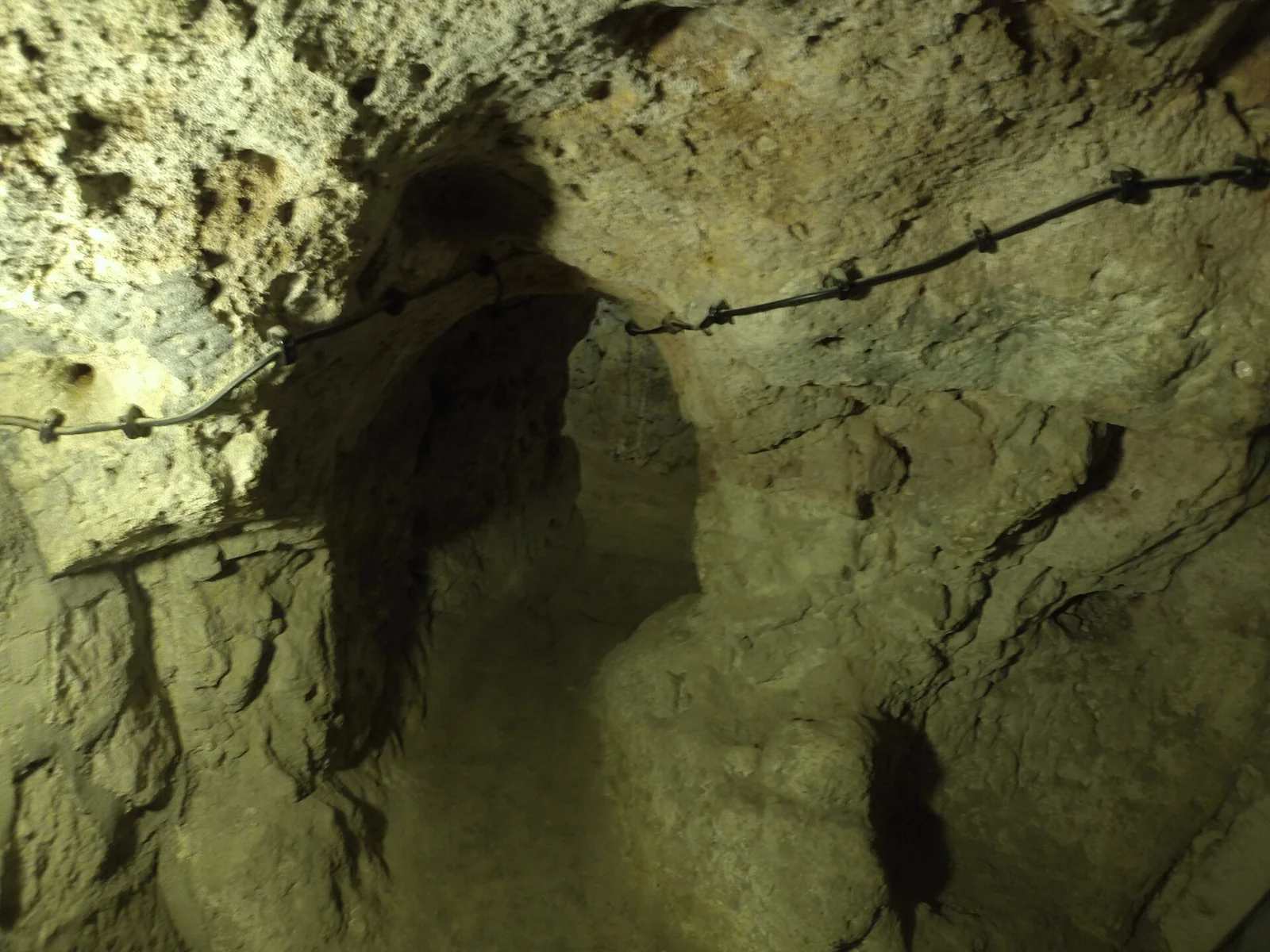
For a photograph, the question is narrower still. Ask which opening is shown and whether its base is visible. A dark shaft can appear very deep without showing an endpoint at all. A photograph of a rail beside that opening records a modern barrier, rather than a depth scale. The camera's position can also differ from the public standing point.
If a guide gives a precise figure, ask whether it concerns the rooms or the well. You can record that answer without challenging the whole museum account. The useful result is a correctly named feature. It lets the museum's broader description and the geological study remain readable side by side, with neither turned into a claim about the exact public walk.
Continue planning your visit
Verdict on Derinkuyu depth
Read Derinkuyu depth with the feature in mind. Keep “about 85 metres” attached to the museum's reported depth. Preserve the separate figures for shafts and the probable thickness of the rooms. Plan your visit from current route information, since the deepest known feature is not the same thing as the lowest point open to visitors.